Every single resident of Bracken County, Kentucky, is “rural,” according to the Census Bureau. So why does this county of 8,500 people generally get lumped in with the nation’s largest metropolitan areas when we study economic trends? A “rural” resident of the “major metropolitan area” argues for more nuance in how we talk about rural.
For the many years I spent living and working in Boston, Massachusetts and its surrounding cities, my morning commute involved brisk walks down sidewalks, crowded subway platforms and screeching trains, escalators, more sidewalks, and elevators that lead to offices in tall buildings.
Two summers ago, I jumped ship from a life I loved in New England to raise my family and open new doors of professional opportunity here in Kentucky.
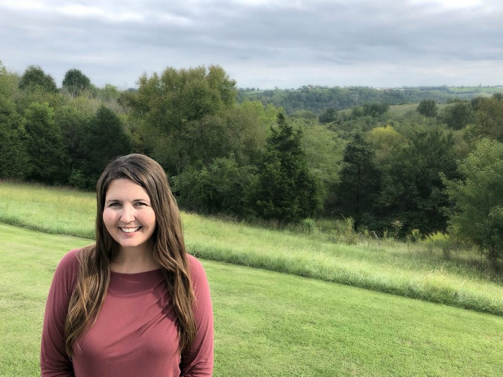
These days, my route to work involves a seconds-long walk across my driveway to a 10-by-12 shed. From the screen door that leads to the shed’s little porch, my office view includes hayfields, pastures, and several stands of trees. In the foreground, just across the fence line, stands a grumpy bull who likes a particular shady spot on the on the dam of an insubstantial cow pond. In the distance, atop the farthest ridge, I can make out a smattering of other farmhouses and barns.

Bracken County, Kentucky is a long way from Boston in more ways than one. And yet according to one of the most frequently-used systems for defining what is rural and what is urban, both places are counted in the very same column of data, along with our nation’s other most urban locales.
By the prevailing metrics, it’s as if I never moved at all.
By any of the informal standards catalogued by Bryce Oates in his recent essay, Measuring Rurality. And Using Data to Inform Better Rural Policy, however, my little spot in Kentucky would safely count as rural. Parking is a non-issue. You can pee outside wherever you’d like (though it might be best to face away from the nearest road, out of courtesy). And if it’s as simple as “you know a place is rural when you see it,” then anyone who looks around this beautiful part of the country can agree that Bracken County is it.
On the days each week when I have meetings, I have no choice but to drive, since we now live 45 minutes, an hour and 45 minutes, and two hours by vehicle from the three city centers of Cincinnati, Lexington, and Louisville, respectively. This next statement feels obvious, but I’ll make it clear anyway: we have no sidewalks, and we have no public transit. I can breathe more deeply among the hills of Kentucky than anywhere else I’ve ever been, and so I don’t mind the long miles of poor cellphone reception along winding, narrow backroads sometimes congested with errant turkeys and sun-bathing dogs. I occasionally show up later than I’d like due to getting stuck behind Amish horses and buggies, or depending on the season, wagons loaded down with hay or tobacco headed for the warehouse. I’ll keep all those inconveniences and throw in a lifetime without pizza delivery for the joy of living right where I am.
But what about the people who aren’t here, and are instead looking at us through a chart of numbers?
From a raw data standpoint, I think the numbers do a decent job of capturing many of the differences between my old life and the life I live now:
In Suffolk County, Massachusetts, there are 784,230 people living in 120 square miles, for a population density of 6,535 people per square mile.
In Bracken County, Kentucky, there are 8,488 people living in 209 square miles, for a population density of 40 people per square mile.
The numbers that set our federal policy come from more complicated data sets, however, like the Rural-Urban Continuum Codes, developed by the Economic Research Service, which is part of the Department of Agriculture. If defining rurality is, as Oates declares, “part science and part art,” then what use is a scientific formula that categorizes Bracken County, Kentucky as a 1 out of 9, ranking us among the very largest metropolitan areas in the United States?
I wish I’d had Oates’s article as a primer last year, when I stumbled backward into the Rural-Urban Continuum Codes and myriad other definitions of rurality while compiling data for an article on rural access to justice that I co-authored for the Harvard Law & Policy Review. It was during the exercise of running my current and former addresses through the various data sets out of pure curiosity that I first learned that my home in Kentucky is not, at least not by some definitions, “rural” after all.
There are many definitions of rurality used by government bodies, researchers, and other policymakers across the country. The U.S. Department of Agriculture (USDA) alone recognizes nine definitions of rurality: three of them are based on census places, three others on census urban areas, one on designations of Office of Management and Budget (OMB) Metropolitan Statistical Areas (MSAs), one on USDA ERS Rural-Urban Commuting Area Codes, and yet another based on the USDA Business and Industry Loan Program definition.
Confused? Me too. But these definitions have real-world consequences that go beyond my irritation when someone on the other end of a conference call map-splains my town as “part of the Cincinnati MSA, so essentially a suburb of Cincinnati,” and I do my best to not counter with, “You have clearly never been to this neck of the woods.”

According to several of these nine definitions, the rurality of a given area depends on where that area falls on a numerical continuum that spans from most “metro” to most “nonmetro” – terms that are, often and dangerously, used interchangeably with “urban” and “rural.” When I checked my address against these data sets, I discovered that my area was generally classified as metro due to falling within the Cincinnati MSA that was mentioned on that phone call. I searched for my county’s placement among the Rural-Urban Continuum Codes, which are used to assign every county in the United States to one of nine numerical designations of metro or nonmetro (and thereby conflate the terms urban and rural with metro and nonmetro, right there in the same classification system). You can imagine my surprise when I found my new Kentucky home pegged all the way at the end of that scale as a “1,” meaning Bracken County, Kentucky was lumped in in with the most urban/metropolitan places in the United States.
New York, New York. Los Angeles, California. Boston, Massachusetts. Johnsville, Kentucky.
To further complicate matters, the U.S. Census Bureau takes a position that is much different than the USDA’s when it comes to defining rurality. Through an interactive map on their website that’s replete with facts about rural America, in a section subtitled “Dispelling the Nonmetro Myth,” the Census Bureau boldly declares that the terms “nonmetro” and “rural” are not synonymous, regardless of how the USDA ERS uses them – and regardless of how often those terms are used interchangeably by people who make important decisions, such as federal employees who conduct analyses of conditions in “rural” America and establish eligibility criteria for critical pockets of federal funding reserved for rural people and places.
The Census Bureau goes on to proclaim that over half of people living in rural areas live within a metro area. In other words, in the eyes of the Census Bureau, the vast body of data we have about rural people, as collected and analyzed under USDA ERS definitions, excludes roughly as many rural people as it includes.
And sure enough, in contrast to our 1 on the USDA ERS’s Rural-Urban Continuum Codes, according to the U.S. Census Bureau Data, 100% of Bracken County’s population is designated as rural.
That’s a dramatic shift in perception that depends solely on which data point used to define us.
The problem here is much bigger than a cultural crisis of identity. Conflating notions of urban and rural with notions of metro and non-metro and mixing usage of USDA ERS definitions with Census Bureau definitions creates a muddy mess of what we think we know about broadband access, healthcare, employment, education, poverty, and so much else, both here and there. It means that the lines we use to separate the haves and the haves-not on any given topic appear less stark than human experience suggests, since under-counting the issues only serves to soften the statistics on either side of the line. From a programmatic perspective, it means that streams of funding for services intended to level the playing field do not reach some communities that might most need it, or that might best utilize it.
Not surprisingly, I agree with Oates that rural statistics are undercounted. I also acknowledge that being over-inclusive when defining rurality comes with its own share of problems. I am far from a statistician, and I so I won’t proclaim to know how we resolve these blinding incongruities, how we concisely capture the nuances of these places that we see as rural and urban with our own eyes but that sometimes appear as something else entirely through the guise of someone’s calculator. Anecdotes and personal narratives don’t fit neatly within any graph.
Yet through first-hand experience of the inadequacies of our prevailing metrics and following Oates’ lead, I can’t come up with a better place to start. And in the meantime of a better solution, perhaps continually bringing the art of rural into public discourse might encourage the science of rural to catch up.
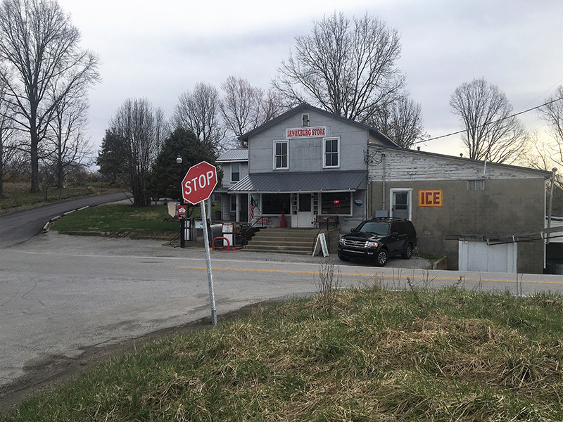
So let me tell you about our general store about 15 minutes up the road, and how it beats the convenience of any box store – which is good, since we don’t have one of those in our county – because you can buy shampoo and live bait, get your deer processed, order a deli sandwich, hear some live music on Saturday nights, and catch up on the local gossip all in one stop. My husband didn’t have to wait in a line nor argue with a self-checkout machine when he sprinted through the doors one crisp November afternoon to buy me a giant bottle of water as I waited in the car in the throes of labor, practicing my breathing techniques as we began our 90-minute dash to the hospital.
I’d also like to record the time our county clerk tracked my uncle down on Facebook because she couldn’t find my phone number but wanted to make sure to let me know that she’d successfully transferred my car title to Kentucky.
I’ll tell anyone who’ll listen how grateful I am for the ambulance and paramedics who showed up to our house in record time during an emergency last February, and how too few of our county’s first responders get paid anything at all for the life-saving work they do.
I’d also like to give thanks to the Bracken County News and the weekly newspapers from our surrounding counties, since without them, I’m not sure when or where our news would ever be reported.
I should also report that my internet works less than half as well here as it did in Boston and that it costs twice as much. And that in contrast to some of my neighbors, I’m lucky to have an option to buy internet at all. When Susan Crawford paints a near-term horizon upon which “widely and competitively available” fiber connectivity can bring our entire country “new businesses, new transport capabilities, new ways of managing our use of energy, new forms of education and health care, new ways of earning a living, and new forms of human connectedness,” and warns that without it, our nation will be “missing out on the future being lived and built elsewhere,” let my TestIT app results of 6.68mbps download speeds and 1.08mbps upload speeds expose how far behind we are all lagging in that race.
I want to enter into the record that when my family goes “to town,” we typically cross the Bracken-Mason County line into Maysville, which has a city population that tops the population of our whole county. And yet Mason County is designated as a 6 on the same Rural-Urban Continuum Codes that say we are a 1. In 1993, Bracken County was defined as an 8 out of 9 on that same continuum and yet over the course of a single decade, presumably due to the construction of the AA Highway which better connects us up toward Cincinnati, we had reached the pinnacle of urbanity at a 1. In light of this dramatic change in classification, I want to challenge the embedded assumption that a highway’s ability to more efficiently deliver our workforce to employers in a larger city (and in a different state, no less) correlates to dramatic shifts in the needs experienced by – and services available to – the people who live here.
Finally, I’d like to recognize the strength in numbers we have in our country’s vast lands of metropolitan rurality and call out just a few of the notable residents included among our ranks. Wendell Berry, Kentucky author, farmer, and living embodiment of rural, farms his homestead in Henry County and also finds himself kicked all the way into the “1” column of the rural-urban continuum, thanks to Henry County’s relative proximity to Louisville. Sarah Smarsh wrote a gorgeous book about class, culture, and opportunity through tales of her childhood spent as a farm kid on the windswept Kansas prairie; as it turns out, Smash’s family farm falls in metropolitan territory, as well. Even the Grand Canyon finds itself sitting on the metropolitan side of the fence. Check the data for yourself – you might be in the club, too.
Regardless of where you fall on any given chart of numbers, let’s acknowledge the shortcomings of those charts and the very real consequences of getting it wrong. And let’s work together toward a better means to capture our nation’s nuanced rural landscape – one that more closely resembles what we see with our own eyes.
Amanda L. Kool is a lawyer, consultant, and author who lives in Bracken County, Kentucky. Her recent publications include the Legal Needs Assessment for Kentucky Entrepreneurs, published in collaboration with the Kentucky Bar Association, and “Legal Deserts: a Multi-State Perspective on Rural Access to Justice.”


